

A preponderance of sunny days is one of the great perks of the Front Range region, no matter the season. While plummeting temperatures and precipitation can make high country trails less accessible, the eastern flank of Pikes Peak and the foothills continue to offer exhilarating trail options for runners seeking a fresh perspective in their workouts or training. Here are three classic trails of varying difficulty that will be sure to keep you outdoors and ignite your trail running fire.
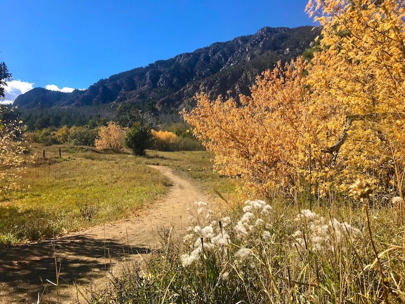
Zook-Blackmer Loop
Location: Cheyenne Mountain State Park, Limekiln Trailhead
Distance: 4.6 mile loop
Elevation Gain: about 600 feet
Difficulty: Easy to moderate
Why You Should Go: This trail run is one of the favorite shorter loops at the heart of Cheyenne Mountain State Park, a trail-running mecca for those in the know. Combining the Zook and Blackmer trails in a clockwise sweep, runners ascend from prairie grasslands into uplands of thick scrub oak and conifer forest. The undulations and switchbacks of the rocky and rooted singletrack divulge wildlife, secluded meadows and boulder-strewn hillsides. The climbing culminates on a forested ridge, and runners are greeted with a series of lively rock gardens and expansive vistas to the east. Here the loop’s second half kicks off a delightfully twisty descent against the backdrop of the triple-peaked monolith of Cheyenne Mountain. Run this trail for speed work or easy recovery.
Route: The clearly marked trail loop starts and ends at CMSP’s Limekiln trailhead. Head west briefly on the Talon Trail to pick up the left fork of Zook Loop. Continue to the Blackmer junction, located at a rock garden in a stand of young ponderosas. Take Blackmer left, and follow its clockwise course. Watch out for the sharp right turns at the Cougar’s Shadow and Boulder Run junctions. Turn left when you reach the Zook Loop junction, and return to the trailhead.
Know Before You Go: An entrance fee is required for Cheyenne Mountain State Park. Day pass: $7. Annual pass: $70. Dogs are not allowed on Zook or Blackmer trails.
Paul Intemann Memorial Trail
Location: Section 16 Trailhead, Gold Camp Road, Manitou Springs
Distance: 6.3 miles one-way
Elevation Gain: about 1,200 feet
Difficulty: Moderate
Why You Should Go: Ascending the dynamic switchbacks of the Palmer Trail to Intemann’s takeoff point quickly sets the tone for this colorful run, as swathes of scrub oak and conifer yield to the canyons and pink-hued sandstone formations of Red Rock Canyon Open Space. The Intemann meanders toward the northwest, plunging in and out of shaded canopies and caressing the rugged contours of the foothills. The wow factor soars with dramatic views of Garden of the Gods, lower Ute Pass, Manitou Springs and Pikes Peak. The climb from Crystal Park Road to Iron Mountain accentuates the Intemann’s athleticism, and the roller coaster finale to the Iron Spring trailhead leaves runners begging for more. Want more distance or elevation? Add on the out-and-back to the summit of Red Mountain (about a half-mile before Iron Spring), or turn around and head back to the Section 16 trailhead.
Route: From the Section 16 trailhead on Lower Gold Camp Road, follow the Palmer trail (keeping left to avoid Red Rock Loop connector trails) for about three-quarters of a mile to the Intemann Trail junction. Turn right and continue on the well-marked Intemann Trail, part of the Ring the Peak Trail system, all the way to the Iron Spring trailhead in Manitou Springs. Be aware that the trail crosses two roads, Crystal Park Road and Pawnee Avenue, and that the summit of Iron Mountain is accessed via a very short spur trail.
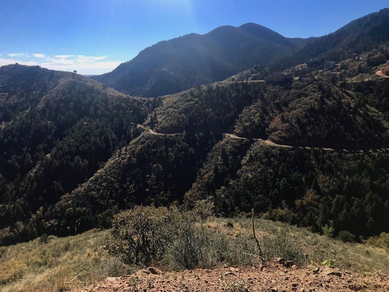
Mount Rosa from North Cheyenne Cañon
Location: Gold Camp Trailhead, North Cheyenne Cañon
Distance: 13.5 miles round trip
Elevation Gain: about 4,200 ft
Difficulty: Strenuous
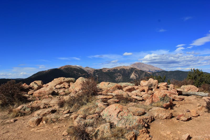
Why You Should Go: For runners with some fitness in the bank, the trip to Mount Rosa is an inspired adventure with more distance and elevation gain than many 14ers. The tranquil start belies the endeavor ahead, as Gold Camp Road’s smooth passage below Mount Kineo leads the run toward Trail 624’s ascent. Initially rolling, Trail 624 begins its ascending dance alongside a friendly creek through the heavily forested Buffalo Canyon. As it runs past the trail to St. Mary’s Falls, 624 grows increasingly technical over a first set of switchbacks, and it transitions to staunch intensity under the watchful eye of Stove Mountain.
The straightening path along upper Buffalo Canyon affords a brief respite in grade and provides the first views of Mount Rosa. A second progression of arduous switchbacks to the upper north ridge of Rosa is the crux of this course. In the final push to Mount Rosa’s summit at 11,499 feet, lichen-adorned rock and diminutive conifers signal the arrival to the subalpine world. And take note that this north-facing stretch can hold snow long after a storm. But runners here are rewarded with glorious panoramic views that include Pikes Peak and Almagre Mountain.
The long descent back to the trailhead is nothing short of thrilling. Consider the side trip to St. Mary’s Falls for just a little extra fun.
Route: Starting at the Gold Camp trailhead from the upper parking lot in North Cheyenne Cañon, take Upper Gold Camp Road all the way around its big bend. Head southwest just past the gated, collapsed tunnel to the junction for Trail 624. Bear right to continue on Trail 624 toward Mount Rosa. Keep right at the junction for St. Mary’s Falls (mile 2.8). When the trail arrives at a gate and Forest Service Road 381 (mile 4.75) bear right briefly on 381, and then turn left to continue on Trail 624. Trail 624 terminates at the junction of Trails 672 and 673 (mile 6). Head straight up on Trail 673 to reach the summit of Mount Rosa. Reverse the route to return to the trailhead. These trails are not well marked; it’s best to bring some foreknowledge and a map.
Read More
7 Short Easy Hikes in the Springs
Favorite Trails for the Out-of-Town Guest
3 All-Weather Trails to Try Now
