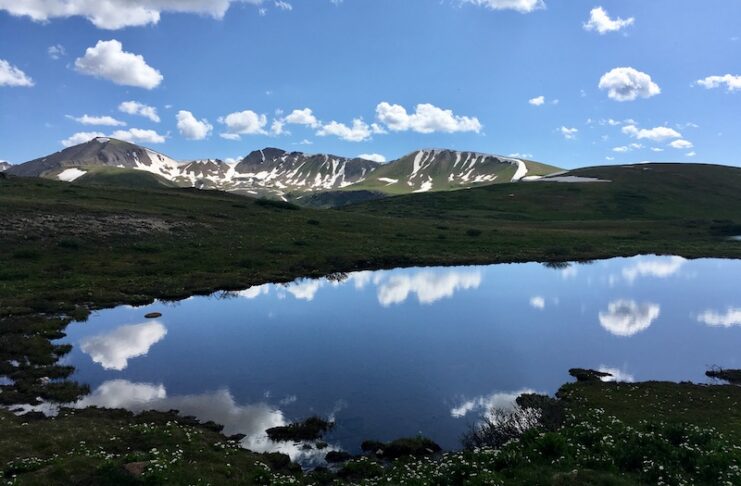
I do not have ducks on my dashboard. (That’s a Jeep thing if you have to ask.)
Brǔno, the 2014 Mercedes-Benz Wagon, has had his nose repainted twice, tires changed through four sets under my ownership, and has no body roll even when swerving at high speed to dodge a buck pronghorn after dark that grazed the entire right side. The Germans didn’t envision dirt roads for their Eurowagon, but they did envision high alpine passes, quick descents and “grand touring.” My ride is basically a Super Subaru. I’ve had it for nine years, packed 140,000 miles onto it, and it swallows fishing gear, fly rods, my mountain bike and sometimes a case of Western Slope peaches.
Do you like switchbacks? Do you like waterfalls? Do you believe guardrails make the scenery bland? Then make a playlist, start up your own mountain mobile and head west on these best mountain passes in Southern Colorado.
This is a completely subjective list. There’s little proof. The opinions below are mine. So are the stories. The selections are limited to passes south of I-70 for their proximity to Colorado Springs. Were they not, Trail Ridge Road in Rocky Mountain National Park is the undisputed champion of mountain passes in Colorado. However, such glory requires planning your entire summer around. Our passes down south can be accessed today.
These favorites are all about making the lifestyle accessible. Enjoy the tour.
The Dallas Divide
Colorado Highway 62: Map
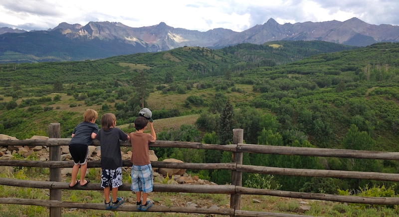
For beauty and awe per mile, Dallas Divide is hard to top. Mount Sneffels to the south. A winding switchback with wide berms and glorious vistas. The “Cheeto orange” explosion the first week of October when the aspens turn a radioactive shade of yellow. Ridgway at the bottom. Telluride in the distance. Ralph Lauren’s Double RL Ranch with the prettiest fence this side of Jackson Hole alongside the road. Driving the Dallas Divide is short but so sweet.
Elevation at Summit: 8,983 feet
Fall Color: 5 Stars
Summer Crowds: Heavy
Winter Driving: Accessible
Winter Scenery: 5 Stars
McClure Pass
Colorado Highway 133: Map
Living on the Western Slope for three years, the fastest way from Montrose to Denver was to go “the pretty way,” with little traffic and plenty of headwaters and redwood-like aspen groves. This road covers everything the Western Slope offers.
It starts in desert in Delta, goes up the mighty Gunnison River, winds through agricultural orchards culminating in happy, hippie Paonia and then starts the ascent at Paonia Reservoir. Above Paonia Reservoir is the stunning, fluted Ragged Mountain, home to the largest landslide event in Colorado history. This lovely valley would seem to be the place filled with big mountain homes, but such slides are why that’s not so likely. Landslides are common all over the place here, and Highway 133 likes to shut down in the spring or during monsoon rains when boulders come crashing down.
At the top is an aspen grove that rivals the best the state has to offer. It’s not especially high at 8,770 feet — it’s just … pretty. The descent takes you through the towns of Marble and Redstone, famous for their quarried rock that built the Colorado State Capitol, the Lincoln Memorial and the Washington Monument. The Crystal River begins here and starts its barreling cascade to Carbondale. Drought years are no fun on the Crystal, but Super El Nino Years, like the ones I got to drive in the ’90s are memorable.
In July and August, make time for cherries, pears, peaches and in September the best apples. Want to introduce your kids to camping and live music? Big B’s in Hotchkiss.
Elevation at Summit: 8,770 feet
Fall Color: 5 Stars
Summer Crowds: Light
Winter Driving: Accessible
Winter Scenery: 3 Stars
Wolf Creek Pass
U.S. Highway 160: Map
Our first entrant on the “scare Grandma/why are we driving this?” routes of Colorado. My first recollection of Wolf Creek was, in fact, terrifying my New Jersey grandmother on a trip to Durango when we reached the summit from the west and then disappearing into a veil of thick fog on the eastern side. Another trip back in 2001 included an encounter at midnight with a house-sized boulder blocking two lanes of traffic on the west side after April snows had started to melt.
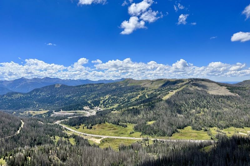
Wolf Creek Pass has nearly 7% grades on both sides, two runaway truck ramps on the west side, the snowiest day ticket ski area in the state, and an 11,760-foot summit. For lovers of 1980s movies, the Griswolds camped at the eastern side in South Fork, just above the mighty Rio Grande, in National Lampoon’s Vacation.
The ascent from the east side begins quickly and gains nearly 3,500 feet from South Fork. There is no shortage of scenery, nor sheer cliff alongside the road. Nearing the summit is a 900-foot tunnel. The top of the mountain averages nearly 400 inches of snow each year, and Wolf Creek Ski Area sits at the summit, backed up against the Continental Divide and the Colorado Trail. The western side feels steeper, and that’s why there are two runaway truck ramps. Streams converge to form the San Juan River at the bottom of the pass before it spills out 4,000 feet lower in elevation in the happy hot springs of Pagosa Springs.
Elevation at Summit: 11,760 feet
Fall Color: 4 Stars
Summer Crowds: Moderate, Heavy on holidays
Winter Driving: Frequently closed in winter storms
Winter Scenery: 5 Stars

Kebler Pass
Gunnison County Rd. 12: Map
How good are these passes? From this point forward, some will start casting first place votes for each pass. Kebler is warranted. Colorado has a debate with Utah as to who has the largest aspen grove on the planet, and Colorado’s representative is basically the entire length of Kebler Pass. If you like aspens, you can’t do better. If you like dirt roads that are forgiving, you also cannot find a better one. If you like to drift around corners in thunderstorms, boy is this a blast. The scenery is a nonstop riot, and the avid fly fisher in me says this despite the fact that there is no prominent river or stream its entire length.
The 30 miles of Kebler Pass have a recommended drive time of 1.5 to 2 hours, which honestly is pretty long, but there are plenty of slowpokes on this route because, well, it’s magnificent. As part of the West Elk Scenic Byway, the drive begins below Paonia Dam on the west side and ends at everyone’s favorite mountain town, Crested Butte, on the east. Along the way are turnoffs for Lake Irwin, Magdalena Mountain, Beckwith Pass and the Ruby Range of the West Elks. The camping in here is fantastic. The smiles are wide. And if you are not a fan of the 1,000-foot drop-offs without guardrails, well, this 10,007-foot summit through glorious valleys might be your cup of tea.
Elevation at Summit: 10,007 feet
Fall Color: 27 Stars
Summer Crowds: Moderate, Heavy on holidays
Winter Driving: None. Closed in winter storms
Winter Scenery: Closed in winter
Cottonwood Pass
Chaffee County Rd. 306/Gunnison County Rd. 209: Map
If it feels like all roads lead to Crested Butte for this author, you’re paying attention. Cottonwood used to be the most disappointing pass in Colorado. On its west side, Gunnison 209 was a farcically maintained, 13-mile washboard, and even after a rain it was a cloud of sticky, tacky dust. Whatever beauty might have been out the window was practically invisible from the ever-present haze. Fifteen years ago the Pro Cycling Challenge decided it would be fun to take the world’s best cyclists and punish them by having them ride from Gunnison to Almont, up the Taylor Canyon, across several cattle guards, ascend a 12,119-foot gravel pass on one inch tires, rocket down the east side, turn at Buena Vista and ascend the Upper Arkansas Valley, turn again at Twin Lakes, and then finish the day riding up and over the 12,095-foot Independence Pass into Aspen. The Queen Stage was an asinine 130 miles of riding with 10,000 feet of vertical elevation gain in a single day. But maybe it was enough to convince authorities to finally pave Cottonwood Pass, which was completed in 2019.
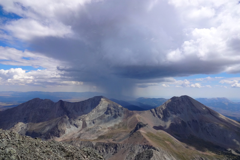
As famous as Independence Pass is, Cottonwood is even higher. Splitting Mount Princeton and Mount Yale on the east side, it crests at the Colorado Divide and Continental Trail, and it has one of the great vistas in all of Colorado looking down on the Taylor Park Basin and the West Elk Range. There’s a nice turn off at the top, but the restroom facility at the first hairpin on the west side is also a great place for photos. Both sides are moose habitat, and there are also a lot of elk in this area. The west side has the world-famous Taylor River, where steelhead-size rainbow trout congregate beneath the dam of Taylor Park Reservoir. But the Taylor is also one of the better whitewater rivers in the state, and it has fantastic rock climbing and its own population of bighorn sheep. Beware “historic cattle drives” right on Gunnison 209 like I encountered last weekend! Harmel’s on the Taylor is a worthy stop for coffee and the barbecue in Almont is pretty good.
Elevation at Summit: 12,110 feet
Fall Color: 4 Stars
Summer Crowds: Moderate
Winter Driving: None. Closed in winter storms
Winter Scenery: Closed in winter
Red Mountain Pass / Coal Bank Pass/ Molas Pass: The Million Dollar Highway
U.S. Highway 550: Map
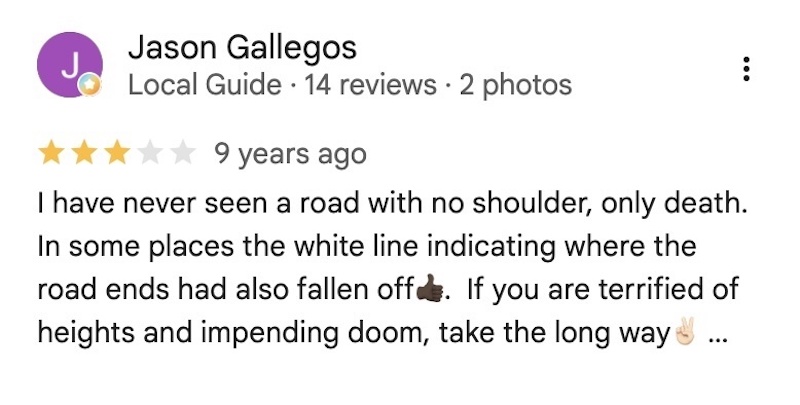
“Can be treacherous in winter,” says Wikipedia. Almost all the passes on this list rate 4.7 or higher on Google, but the mind-blowing beauty of Red Mountain is only a 4.6 because it’s just plain creepy. Guardrails, what are those? A thousand foot drop? Ha. Wait until it’s a 2,000-foot drop before you start freaking out, buddy. Waterfalls right next to the road? Sure. Black granite walls going vertical, and a semi coming northbound from Durango that seems to take up both lanes? Just another June day on Highway 550.
The Million Dollar Highway is bonkers. Not for the faint of heart, its greatness is also simple to comprehend. Ouray is the northern end, and little Switzerland has earned its nickname by nestling up into a cleft at the base of a box canyon. The pass starts with a bang, ascending quickly before opening out into a high-altitude canyon where the road winds via ferrata-style along the middle of the canyon wall.
Red Mountain raises Wolf Creek Pass by more than a percent in grade, regularly topping 8%, and yeah, avalanches close this road numerous times each winter. The road tones down incrementally for the next two passes to the south, Coal Bank and Molas. While Red Mountain is twisty and filled with switchbacks, Coal Bank is just plain sustained elevation. Molas is practically chill before it begins descending down the Animas River drainage toward Durango. The famous Durango and Silverton Narrow Gauge train runs through the canyon below.
Why three passes under one category? Well, if you leave Ouray heading south, you don’t really have any other places to turn off unless you’re jeeping over something truly nuts like Engineer Pass, or taking a breather in Silverton. The point is, if you’re doing one, you’re probably committed to doing all three. Why do they call it the Million Dollar Highway? No one truly knows, but theories include all the million-dollar views or the per-mile price tag to build this rugged road. When’s the best time to go? Well, anytime with sunlight would be my vote. Driving this at dusk or after sunset is not recommended.
Elevation at Summit: 11,000 feet
Fall Color: 4 Stars
Summer Crowds: Moderate to Heavy
Winter Driving: Frequently closed in winter storms
Winter Scenery: If you have the nerves, off the charts — especially on Coal Bank and Molas. Plus, there’s the Ouray Ice Park at the beginning.
Independence Pass
Colorado Highway 82 Map
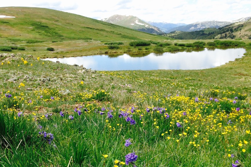
We have the Pikes Peak Highway in our backyard. Mount Blue Sky is west of Denver, and Trail Ridge Road is worth every last ounce of praise. But Independence Pass wins the subjective and the objective. Colorado has numerous great Continental Divide passes, and many of them run through the headwaters of our famous rivers. Independence Pass claims the headwaters to both the Arkansas River on the east and the Roaring Fork River on the west, two of the true greats in the state, and both known for ankle-busting rocks and fast flowing descents. That (usually) abundant water and snowmelt make the foliage extra special. Have you heard of a place called Aspen? Yeah, that’s the destination.
Colorado Springs, this east side is your water source, but so is the west side thanks to the Ruedi Reservoir pumping into Twin Lakes. From the east, Independence Pass starts at the base of our state’s highest peak, Mount Elbert, rising above Twin Lakes. Along the way, a half dozen 14ers can be seen. This road has grin-a-minute views, wildlife, waterfalls, hiking trails, wonderful wildflowers, and the added bonus of high-performance cyclists riding to the 12,095-foot summit with regularity (earlier this summer, I counted 14 on the west side on a Saturday morning).
While not as sketchy as Red Mountain Pass, Independence does have an amusing one-third mile of one-lane road that squeezes past a sheer granite face with no center stripe (or warning for that matter). Vehicles over 25 feet are banned, and you start to appreciate why Sprinter Vans maybe shouldn’t be rented so easily to tourists.
As you near the bottom on the west side, heart pounding a little extra, you enter Aspen, and the most expensive real estate in the United States. Not to put a number on it, but when you arrive in Aspen from the east, it really is Shangri-La. The place makes one heck of a dramatic entry. The furious Roaring Fork River decides to playfully oxbow through a verdant, Tyrollean valley. Paragliders launch off of sheer cliffs, while fireweed and lupine freckle the hillsides. Dazed and perhaps a little shaky from that one-lane stretch and the lack of guardrails, you might be confused as Aspen offers no straight path through town and easy-to-miss signage guiding you along the Highway 82 route. But hey, you’re here to play, right?
Elevation at Summit: 12,095 feet
Fall Color: 5 Stars
Summer Crowds: Moderate to Heavy
Winter Driving: None. Closed in winter storms
Winter Scenery: Closed in winter
With leaf-peeping season on the horizon, don’t miss our Favorite Colorado Drives for Fall Color too.