

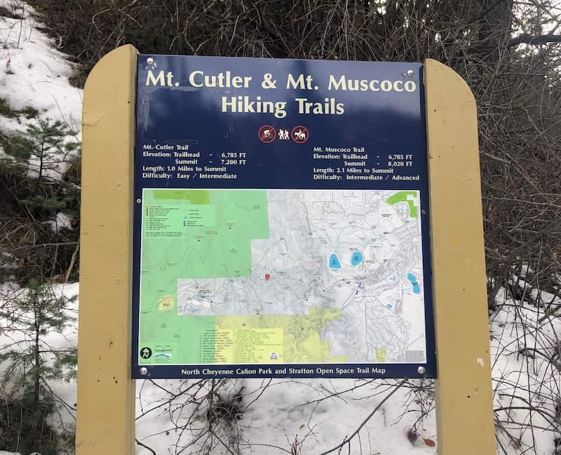
Where to Find It: North Cheyenne Cañon Park
Distance: 2.2 miles out and back
Difficulty: easy to intermediate
Know Before You Go: Foot traffic only. Dogs must be on a leash. Watch for loose gravel year-round and icy conditions during winter.
If you’re looking for city-overlook views, a short hike and an easy-access wilderness feel, Mount Cutler is your trail. Located among the ancient granite of Cheyenne Cañon on the city’s southwest side, the popular out-and-back trail will lead you to an airy vantage point with excellent views of the cañon and city.
From its trailhead off of the main road, the trail rises steadily along the south side of the cañon, making it shady in summer and often snowy and icy in winter or early spring. You’ll cross a sturdy bridge right away and pass beneath large granite outcroppings.
About half a mile into the hike, you’ll come to the top of a ridge and a fork with the Mount Muscoco Trail. To continue to Mount Cutler, stay left along the ascending ridge and follow the loose gravel path. As you continue along the ridge, there are good places on the rock to stop and take pictures or have a snack. Look down into the secluded South Cheyenne Canyon for the zip lines of the Broadmoor’s Soaring Adventure.
Soon, you’ll encounter a standalone tree with a fork in the trail. The path to the left will take you up to Mount Cutler’s true summit at 7,281 feet and some gorgeous views. Stay right if you want to continue to the jutting overlook for clear, beautiful views of the Broadmoor, downtown, Garden of the Gods, the airport and beyond. Yes, you will be descending again, about 150 feet. And it may look like there are a multiple paths, but follow the main ridgeline and watch your step on the loose gravel. Return the way you came when you’ve had your fill of the scenery.
How to Get There
From the Starsmore Discovery Center at the entrance to North Cheyenne Cañon Park, follow N. Cheyenne Canyon Road about 1.5 mile to the trailhead and parking on the left. Watch for cars parked in toward the mountain and a sign with information and a trail map.
Winter Season Warning
Because the Mount Cutler trail rises along the steep and shady north-facing slopes of Cheyenne Cañon, it holds snow and ice long after a storm. The first half-mile or so of the trail can often be icy and slick during cold weather season. Extra traction, such as Yaktrax or Microspikes, is recommended.
Read More
7 Short Easy Hikes in the Springs
Trails: Hike the Ute Pass Trail
Trails: Hiking the Mt Esther Trail
