

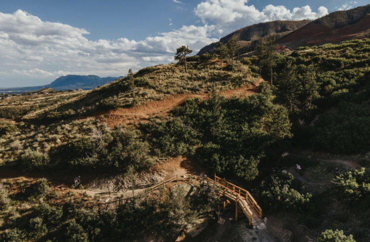
We love our trails in Colorado Springs! And we’re fortunate to have a lot of them — more than 400 miles under city and county management. It takes a lot to maintain and continually improve existing and new trails, and the City of Colorado Springs Parks, Recreation and Cultural Services just released a draft of its new Park System Master Plan (PSMP), giving residents an opportunity to help shape priorities for the city’s parks, recreation, trails, open spaces and cultural services over the next 10 to 15 years. (More on that below.)
Right now, there’s already a lot happening, from new downhill mountain bike trails at Blodgett Open Space to hiking additions at Pulpit Rock and long-term visions for trail connections and new open spaces. Earlier this summer, we sat down with David Deitemayer, the senior program administrator for the Parks, Recreation and Cultural Services Department, to discuss what trail projects are happening now, what comes next and the work that happens behind the scenes to make it all possible.
Here are highlights from our conversation edited for clarity and brevity.
Blodgett Open Space
Springsmag: Let’s start with Blodgett Open Space. A new bridge and 7 miles of new trail opened there this summer. What opened and what can people look forward to?
David Deitemeyer: Yes, we’ve been chipping away at Blodgett for about a year now with the primary focus on opening some open space connections on the southern portion of the open space. But our main focus has been the construction of what we named the Blodgett Bike Hill. Per the master plan that was completed in 2024, we’ve implemented 2.5 miles of dedicated downhill mountain bike trails and incorporated some additional open space trails and what serves as the uphill bike access trail. That is still multiuse, multidirectional, uphill bike trail that provides access to that bike hill area.
We are still scheduled to do improvements and construction of 7 additional miles through the remaining portion of the year, weather dependent. A lot of that work focuses more on the central and northern portions of the open space.
How has the community responded to the city’s growing number of downhill-only mountain bike trails?
Really, since that conversation started with the community through our master plans, there’s been a significant interest to do more bike-only trails. We’ve seen that with our incorporation of the Chutes and Captain Morgan’s in Cheyenne Canyon. We have Black Sheep in Austin Bluffs. We have some bike-only in Ute Valley and now in Blodgett Open Space.
So there’s been a driving community voice that supports single-use trails. And we hear that too from the hiking community, a lot of interest to have hiking-only trails.
We’re tasked with the department to find that right balance so we can provide multiuse access to all of the open space. And when it makes sense, with the support of the community, we look at providing those single-use accesses. From a mountain bike perspective, there is a tremendous amount of interest. It improves the safety. It improves the user experience, and it really provides an offering that multiuse trails just can’t provide.
Are hiking-only trails part of the future as well?
The Blodgett Open Space master plan identifies 1.5 miles of hiking-only trails, and those are in the northern portion of the open space. Through that master plan process, the community supported maintaining more of that hiking feel in the northern portion that was unburned [in the Waldo Canyon Fire]. There’s a lot more tree cover in there. It’s a little more shady and cooler in the summertime, and it lends itself to more of a hiking-only experience that the community wished to have there. So we’re reflecting that with our improvements.
Explore the Blodgett Open Space trail map and more details here and join the official ribbon cutting on Sept. 15.
Austin Bluffs and Pulpit Rock
Another big project is the new trail at Pulpit Rock. What’s happening there?
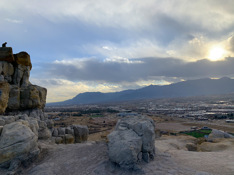
We’re under construction right now with what we’ve called the Enlightenment Trail. That’s a hiking-only trail. It incorporates just over 400 stone steps.
We want to be clear: It’s not like the Incline. It’s not direct and straight. We’ve naturalized it a little bit more to fit into the feel and aesthetics of the open space. But it is relatively straight up, and so we’ve incorporated the steps into it. We’re under construction now and hope to be completed with that by the end of the summer.
What other improvements are happening in Austin Bluffs Open Space?
We’ve also made improvements to both the north and south trailheads for Austin Bluffs Open Space. And we have additional singletrack trail being constructed on what we identify as the Spine Trail. There are two segments. The first was completed in December, and it provides access from the northern portion of the open space near Pulpit Rock from the lower elevations up to the Rim Trail. The portion we’re under construction with now is on the southeast side of the open space, and it provides connection from the higher elevation around Rockhurst and our Rim Trail, continuing southeast, downhill toward the Union and Austin Bluffs intersection.
It’s singletrack. It’s not only a good open space trail, but it unlocks connectivity over to Palmer Park. So now you can ride from Palmer Park through Austin Bluffs using some of our urban trail. You can get over to Ute Valley and then take that all the way up into Blodgett with some of the new trail we’re doing there. You’re connected with very little pavement and road use from Palmer Park to Blodgett.
Find details about Austin Bluffs Open Space here.
The Chamberlain Trail Vision
The Chamberlain Trail extension to connect Blodgett to Cheyenne Mountain State Park has been discussed for many years. Where does it stand today?
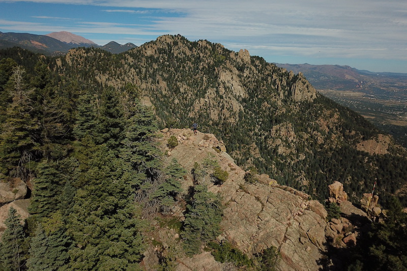
We’ve made some really good headway in the last 10 years. We’ve incorporated the Chamberlain Trail within our Blodgett Master Plan, as well as our Fishers Canyon Open Space Master Plan — on two complete opposite ends of town. To be able to integrate Chamberlain within those is very meaningful to further enhance that connection and that vision.
We have approximately 32 miles of the Chamberlain Trail in the master plan, and we have about 20 miles of that constructed. That incorporates both dedicated Chamberlain, shared use trails like using the Foothills Trail through Garden of the Gods, or using some road connections for connectivity, like through Skyway. But to be about two-thirds completed with that vision that’s been in the works for 25 years, I think is pretty powerful.
What’s the ultimate goal for the Chamberlain Trail?
Singletrack trail across the foothills of Colorado Springs [from Blodgett Open Space to Cheyenne Mountain State Park] that is close enough that you can do segments or you can do the entire length of it in a day. And it really is an experience of being in the foothills along the urban corridor, but feeling removed from the city environment. That’s our ultimate goal.
What are the biggest hurdles to completing it?
Partnerships, community support and buy-in for the project will be important. We’re at those hinge points where trail segments are not completed because of a reason. Typically it’s individual property owners who don’t have an interest or just more challenging connections that haven’t been figured out yet.
If you look at the entire corridor, we have touched components in almost every mile of trail segment, whether that’s legal access through easement acquisition or master planning or physical construction.
What has helped move the project forward?
Not only partnerships and Friends Groups’ support, but support from the city leadership, our TOPS working committee and our Parks Advisory Board. They see the value in supporting those through the planning processes and also finding the funding through our TOPS program (Trails Open Space and Parks) that can dedicate money to purchase and build segments of the Chamberlain Trail. Without that support, we wouldn’t have any of those completed.
Find a Chamberlain Trail map here.
Fishers Canyon
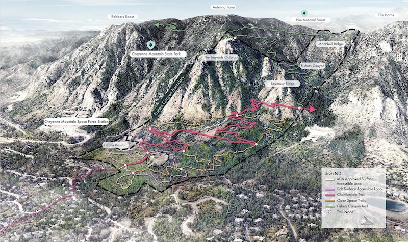
Where does progress stand for Fishers Canyon [the 343-acre open space on the northeast side of Cheyenne Mountain]?
We’re still envisioning that construction would be underway in 2027 with the trailhead and the trail system. While public construction hasn’t begun yet, planning and land-management work are already underway.
Those master plans are really 10- to 15-year guiding documents. So by the end of that time frame, we hope to have accomplished what that plan sets forth. We’re one year removed from the Fishers Canyon Master Plan being approved, and we’ve made progress behind the scenes doing the planning work and prepping ourselves. From a public perspective, it might look like nothing is getting done. But we have been coordinating with utilities, doing some additional investigation on utilities in the area, and we have been doing grant funded fire mitigation this summer.
We acquired that land in 2022. So we’re coming up on that five-year time frame, and we should hopefully have access by next year. For a government time frame, that’s pretty good speed.”
Explore the Fishers Canyon Open Space Master Plan here.
Pikeview Quarry
Another long-anticipated project is Pikeview Quarry. What’s the latest there?
Our big hurdle that we had to clear was accepting the donation, and that was completed in April of this year. We had to go through a few different steps. Primarily, the company who owned the quarry and operated it had to complete the reclamation. It was approved and signed off by the Colorado Division of Reclamation and Mining Safety. At that point, it was offered to the city. We hired a third-party geotechnical engineer to essentially analyze all the work that was done. They ran some additional models to determine whether or not what was done was adequate and that slope is stable. It took several months, and our third-party review confirmed that it was stable, which then gave us the ability to stand in front of City Council with the support of the mayor and city leadership to request acceptance of that donation. That was a huge hurdle to get over, and it is now under purview of the City of Colorado Springs.”
As it stands right now, it’s on our list of unfunded projects that we will pursue in the near future.
It didn’t make it into the 2027 budget cycle for getting any activity, but master planning could potentially begin in 2028?
Potentially, yes. There’s a lot of community interest. I’ll say that. I think the ability to prioritize that in 2028 — I’m highly confident that would find its way to be funded. But a lot can change in a year, and it has to align with our goals through the city and parks leadership.
Find more info on the reclaimed Pikeview Quarry here.
Pikes Peak North Slope
There’s work happening at Pikes Peak North Slope Recreation Area too?
I’m working with Colorado Springs Utilities, Pikes Peak America’s Mountain and Pikes Peak Outdoors to implement improvements and add singletrack trail to the North Slope Recreation Area next year. This will be made possible by partnerships with the Regional Partnership Initiative and an awarded grant through Colorado Parks and Wildlife and Great Outdoors Colorado. It will be a really exciting project with the ultimate goal of moving the recreational use off of the utility access roads and away from critical infrastructure — that alone will benefit the user experience by creating some singletrack connections to that portion of the property.
Looking Ahead
With so many projects underway, what excites you most?
I’ll spend time on a property, let’s say Austin Bluffs, and see the work that we’re doing, see the view, the experience that property offers, and I think, This is just incredible. Then I go and look at the work we’re doing in Blodgett, or I walk around in Fishers, and each time I’m like, Oh, I’m so excited for this connection.
For me, it’s about providing a space for our community to go out and enjoy, to escape their busy lives, to find respite in the wilderness areas that we have, and to do so on a trail that I’ve been a part of is really fascinating. I want to better our community, but I also selfishly want to have a place that my kids love and can explore and enjoy just as much as I did as a child here. So whether that’s on Blodgett, Austin Bluffs or Fishers, just the sheer work alone brings me joy and excitement.
More Colorado Springs Trail and Open Space Projects
Rock Island Trail Improvements
Work began in late August to improve more than 2 miles of the Rock Island Trail between Sand Creek and Constitution Avenue to add safer, more accessible connections for the major east-west trail from downtown Colorado Springs to Powers Boulevard and beyond.
The centerpiece of the work is a new 210-foot pedestrian bridge over Sand Creek that will connect the west and east sides of the trail. A pedestrian-activated flashing crossing will be added at Peterson Road as well. Completion is expected in winter 2027.
Find more info here.
Parks Master Plan
On Sept. 3, the City of Colorado Springs Parks, Recreation and Cultural Services (PRCS) Department released the draft of its Park System Master Plan (PSMP), updated from the 2014 Park System Master Plan. The plan guides priorities for the city’s parks, recreation, trails, open spaces and cultural services for the next 10 to 15 years.
Residents can review and provide feedback on the draft through an online survey (in English and Spanish), available here Sept. 2-22. They can also attend (in person or online) a presentation of the draft plan to the Parks Advisory Board during its Sept. 10 meeting (7:30 a.m.). Public comment will be accepted.
Residents can also attend the following two drop-in open houses to review information and speak directly with members of the project team.
Community Open House
Date: Thursday, Sept. 10
Time: 5-6 p.m.
Location: Piñon Valley Park (in the pavilion), 5585 Mule Deer Dr.
Community Open House
Date: Wednesday, Sept. 16
Time: 5-6 p.m.
Location: PRCS Headquarters – 1401 Recreation Way
Get more info at coloradosprings.gov/ParkSystemMasterPlan.
Ute Pass Regional Trail
A key section of the Ute Pass Regional Trail is nearing completion this year between Cascade and Teller County. The El Paso County Parks project brings big improvements and takes another important step toward the completion of the larger Ring the Peak Trail. Read our full update here.


