

Where to Find It: Northwest Colorado Springs, Blodgett Peak Open Space
Distance: 5.2 miles out-and-back to summit, other trails available
Difficulty: Advanced
Peak Elevation: 9,423 feet
Know Before You Go: Lower trails in the open space are well marked and maintained. The higher trail to the summit is steep, loose and sometimes difficult to follow. It can also hold snow and ice for long periods in cold weather months. Dogs must be kept on-leash in city limits.
Climb to the top of two worlds, city and nature, by summiting Blodgett Peak in northwest Colorado Springs. Or explore the lower trails of the popular Blodgett Peak Open Space for easier, family-friendly loops. Whatever route you choose, you’ll find an accessible gateway to nature as scrub oak blends with pine forest at the base of the Rampart Range. But to peer over the city, Air Force Academy and Rampart Reservoir all at once, it’s the difficult route to the summit you want.
Blodgett Peak stands prominently on the north side of the Springs’ skyline. It is named after one of the first ranching families to settle in the area that is now the Air Force Academy.

The trailhead and open space on the west side of the Peregrine neighbor have seen a great deal of trail development and maintenance, erosion control and fire mitigation in recent years. And scars from the 2012 Waldo Canyon Fire are still visible in and around the area, especially at higher elevations. The lower trails are now well marked; the summit trail is less so the higher you go.
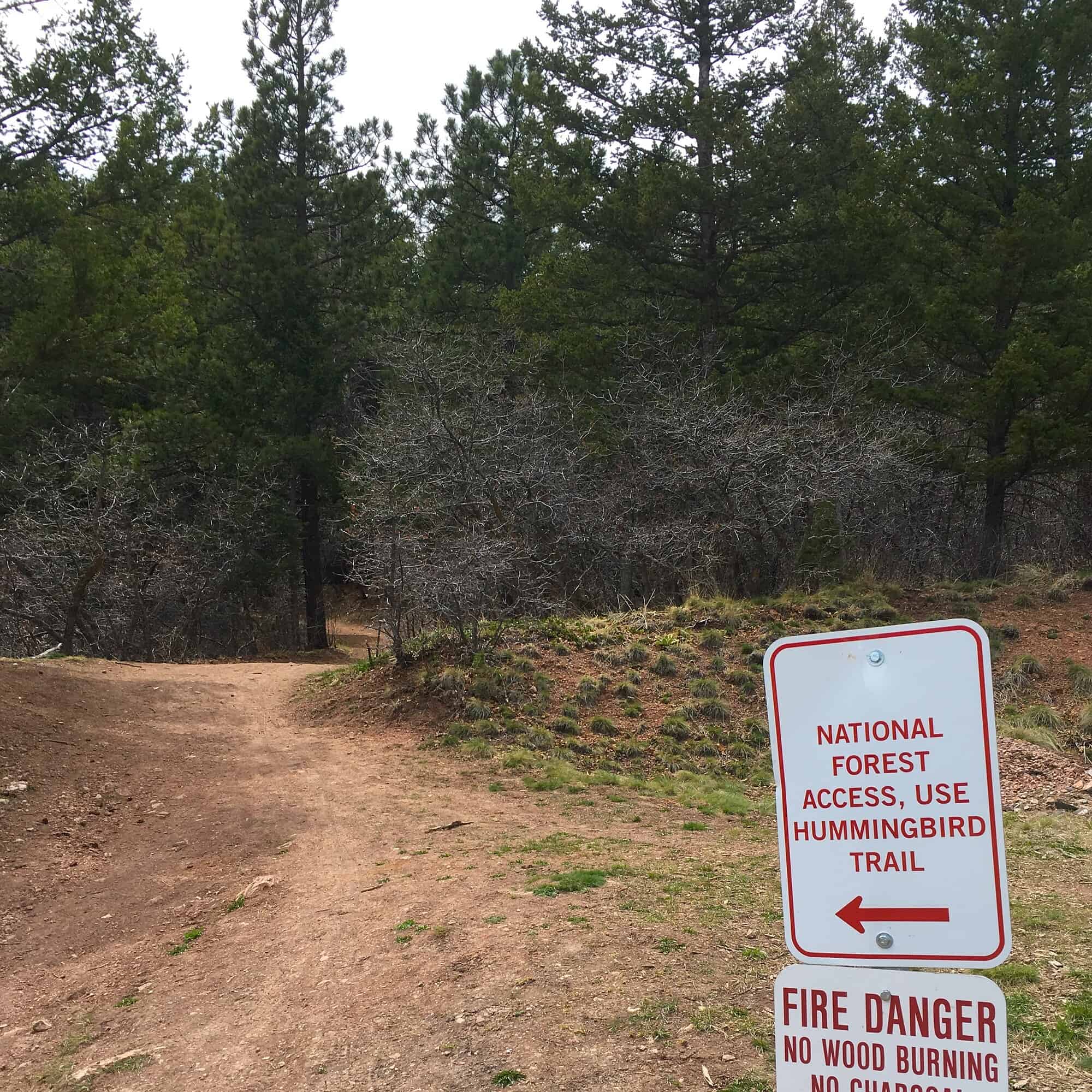
The route to the top begins on Blodgett Trail from the parking lot. You’ll ascend the first 0.6 mile on a wide dirt road. Watch for a left turn onto the Hummingbird Trail with a sign directing you toward national forest access. The city made changes in early 2019 to direct hiking traffic away from the Colorado Springs Utilities water tank about a quarter-mile farther up the road.
You’ll soon leave city property and enter the Pike National Forest as you climb gradually for almost another mile. The trail is shaded here and huge boulders are scattered throughout the forest. Then things get steep—prepare for major elevation gain. At about 1.75 miles, you’ll pass a small waterfall, then encounter Blodgett’s notorious scree fields.
This is where the loose granite makes the climb difficult. The collection of braided paths can be confusing, but all generally ascend in the same direction. Expect to use your hands for steep scrambling over the next few hundred feet.
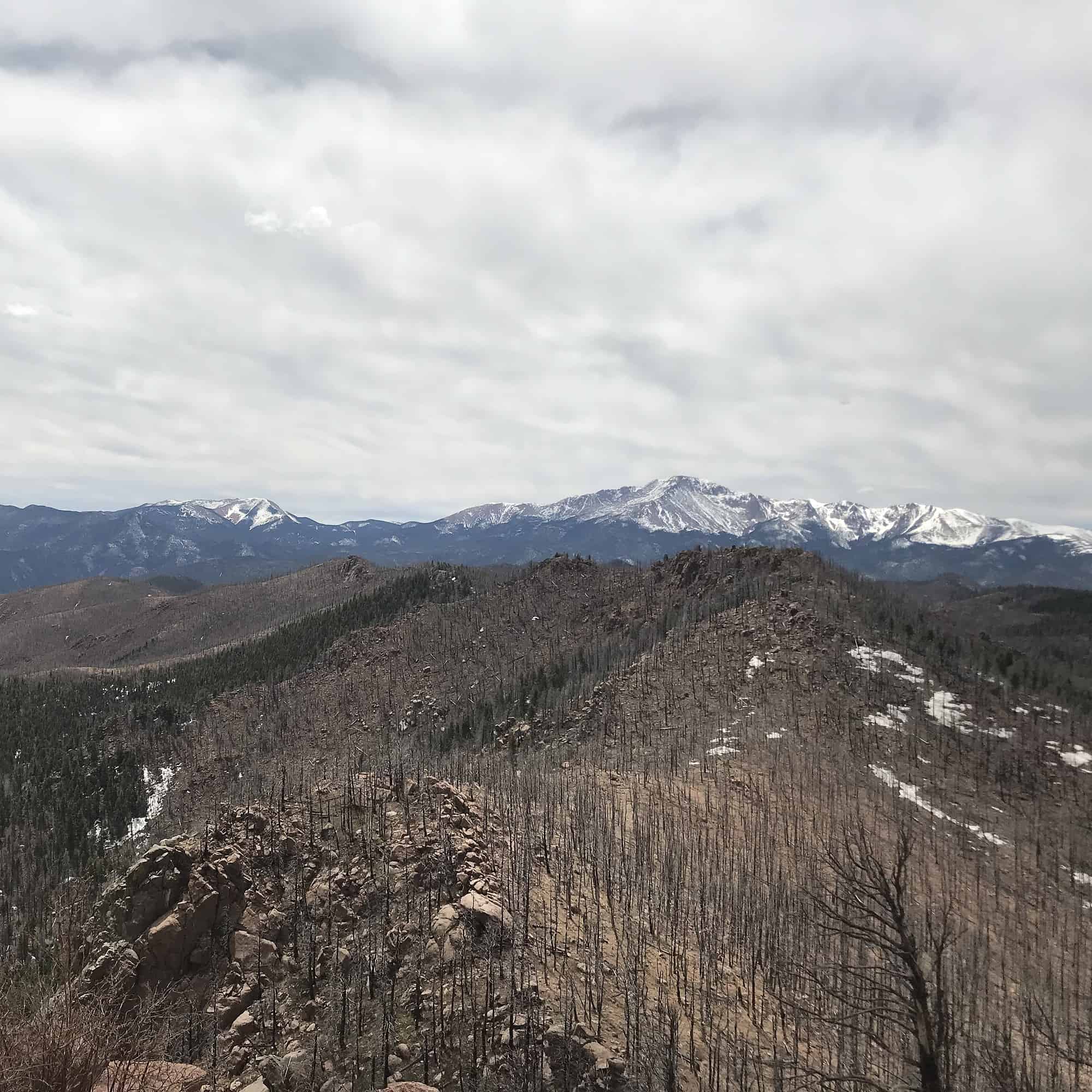
When you top out on the ridge, look for the trail heading left and watch for occasional small orange tags on trees to mark the route. You’ll quickly enter a charred section of forest and begin climbing steeply again for almost a half-mile to a saddle along the upper ridge. From here you can see Rampart Range Reservoir below and Pikes Peak to the south.
You’re also on the homestretch. Head north and follow the cairns to ascend to Blodgett’s summit. Enjoy your scenic rewards at the top, taking in panoramic views of the Air Force Academy, Colorado Springs, Pikes Peak, and Rampart Range stretching north and south. Keep a look out for peregrine falcons who make the area their home.
 Descend the way you came. But be sure to use caution especially on the steep, loose scree fields. And enjoy savoring the memories of your hike whenever you look west and notice Blodgett on the horizon.
Want a Friendlier Trail?
Try these different options in the lower Blodgett Peak Open Space.
The winding lower part of Blodgett Trail still boasts great views of the city with mellow steepness, and you can catch the Ponderosa Trail to loop back to the trailhead.
The Chickadee Trail loops on the hillside then back to the parking lot in a half-mile.
If you continue past the Chickadee Trail and take the next turn onto Dry Creek Trail, you can loop back to the parking lot in 0.75 miles. Don’t miss your turn onto Red Squirrel Trail that will link you back to the parking lot for the last 0.1 mile.
How To Get There
From Interstate 25, take Exit 148 – Rockrimmon Boulevard. Go west on Rockrimmon for 5 miles, then turn left onto Vindicator Drive and follow for 1.3 miles. Turn north onto Centennial Boulevard and continue for 1.4 miles to West Woodmen Road. After 0.8 miles, look for the Blodgett Peak Open Space parking lot on your left.
